GPS Garmin MAP 65
Features:
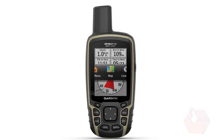
Large 2.6” sunlight-readable color display for easy viewing
Expanded global navigation satellite systems (GNSS) and multi-band technology allow you to get optimal accuracy in challenging locations, including steep country, urban canyons and forests with dense trees
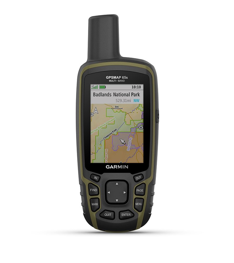
Includes routable TopoActive mapping and federal public land map (U.S. only)
Go-anywhere navigation with 3-axis compass and barometric altimeter
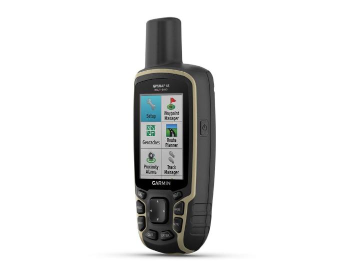
Compatible with the Garmin Explore website and app (compatible smartphone required) to help you manage tracks, routes and waypoints and review statistics from the field
Product Introduction
This device is loaded with features perfect for the avid outdoorsman. Built with a sunlight viewable 2.6” color display that beautifully displays preloaded TopoActive maps for terrain contours, topographic elevations, summits, coastlines and geographical points within US & Canada. Quickly and easily download up to 250 high-resolution photo-like map files directly to your GPSMAP 65 with Birdseye Satellite Imagery to help you locate parking, pick stand locations, and find trails all in the palm of your hand. Built-in smart notifications when paired with a compatible smartphone will display emails, calls, and text alerts right on your GPSMAP device.
Features:
Expanded global navigation satellite systems (GNSS) and multi-band technology help to track your route in challenging environments that would prove difficult for GPS alone
Large, sunlight-readable display measures 2.6 in. with 160 x 240 pixels to present imagery in crisp and colorful detail
Connectivity via Bluetooth and ANT+ lets you share your waypoints, tracks, routes and geocaches wirelessly with other compatible devices
Compatible with Garmin Explore™ website and app to help you manage tracks, routes and waypoints and review statistics from the field
Includes routable TopoActive mapping and federal public land map
IPX7 rating means this is considered waterproof; it can withstand submersion in water up to 1 m deep for up to 30 min.
Specifications
| Best Use | Navigating |
| Preloaded Map | Topo |
| Basemap | Yes |
| Wireless Communication | Yes |
| OS Compatibility | Windows / Mac, Android, iOS |
| Display Size | 2.6 inches |
| Screen Pixels | 160 x 240 |
| Visual Map Display | Yes |
| Color Screen | Yes |
| Number of Routes | 200 |
| Number of Waypoints | 5000 |
| Internal Memory | 16 gigabytes |
| Expandable Memory | Yes |
| Compass | Yes |
| Altimeter | Satellite-based |
| Quad Helix Antenna | Yes |
| Compact Antenna | Yes |
| Position Accuracy | 3 meters |
| Battery Type | NiMH |
| Batteries | 2 AA |
| Average Battery Life | 16 hours |
| Dimensions | 6.3 x 2.4 x 1.4 inches |
| Water-Resistance Rating | IPX7 |
| Weight | 7.8 ounces |